Wikisage, the free encyclopedia of the second generation, is digital heritage
File:CapeHornDetailMap.png
Jump to navigation
Jump to search
No higher resolution available.
CapeHornDetailMap.png (800 × 482 pixels, file size: 232 KB, MIME type: image/png)
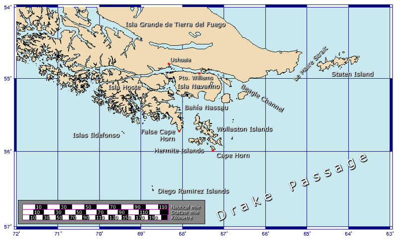
German:Das Kap Hoorn-Gebiet mit der Le Maire-Straße english:Cape Horn area and Le Maire Strait
File history
Click on a date/time to view the file as it appeared at that time.
| Date/Time | Thumbnail | Dimensions | User | Comment | |
|---|---|---|---|---|---|
| current | 12:52, 30 January 2016 | | 800 × 482 (232 KB) | Penarc (talk | contribs) | German:Das Kap Hoorn-Gebiet mit der Le Maire-Straße english:Cape Horn area and Le Maire Strait |
You cannot overwrite this file.
File usage
The following page uses this file: